Thursday, October 14, 2010

Cool Fall Seeds

I've been walking about a lot lately, for pleasure and work. This is not really a problem since it is perhaps the nicest time of year for wandering around in natural places. Fall colors are peaking in our neck of the woods. The colors are gorgeous, especially the red maples.


The beautiful leaves overhead and underfoot easily distract. Plants are not only changing colors, they are producing seeds: nuts, berries, achenes, and other fruits. Of course, this year it is hard to miss the hard, loose carpet of acorns -- a banner year for oaks. Berries seem less abundant, the strange weather of Spring 2010 seems to have dampened fruit production in some plants including apples, peaches, grapes, and many Viburnums.

A couple plants caught my eye in the last week, even amidst the rich palate of fall foliage. Their leaves are not colorful, yet each produces some rather showy seeds: common milkweed and Virgin's bower.

The common milkweed (Asclepias syriaca) is one of those plants critical to the monarch butterfly. Monarch caterpillars rely entirely on milkweed plants for food and growth. The cardiac glycosides in milkweed make monarch caterpillars distasteful to predators. The last batch of monarch butterflies to emerge from the chrysalis are the migratory ones, now making their way to Mexico on favorable winds. Likewise, the seeds of the milkweed plant are bursting forth from their capsule and taking flight on the wind.
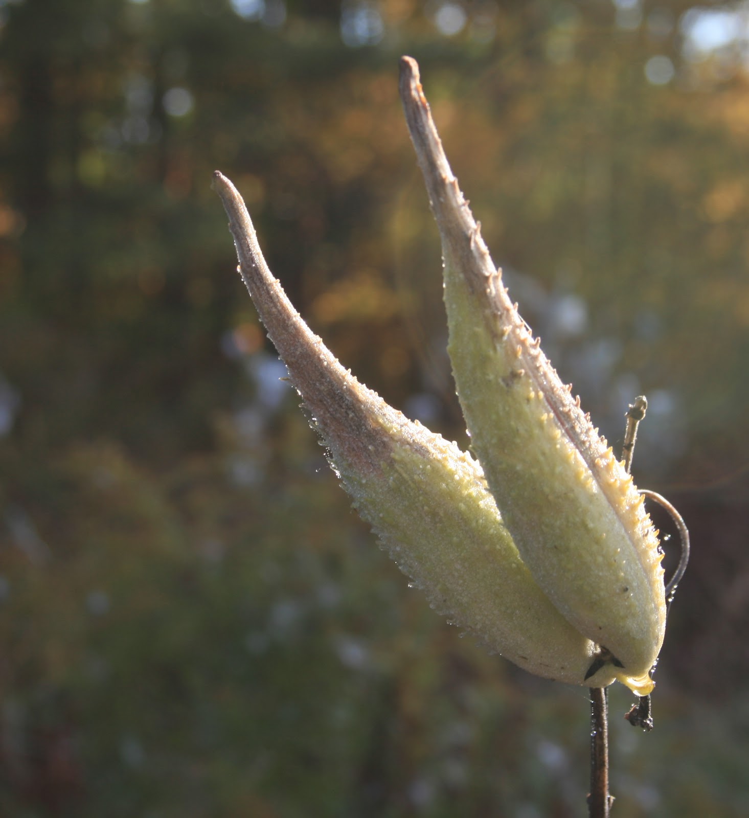


Milkweeds are a common, native plant in meadows; they do so well in disturbed areas that some think of them as invasive. Yet many insects would beg to differ. Besides the monarch, bees, wasps, flies, skippers, and other butterflies sip its nectar. And other bugs, bees, and moths search out its pollen. For me, the bursting forth of the silky seeds in a field is a beautiful sight.

Virgin's bower is an odd plant that grows in wood and field edges, thickets, and stream sides. It is a vine, as its name -- Clematis virginiana -- suggests. This plant is more common than I realized. I see it in almost every moist thicket, twisting and climbing among the shrubs. This time of year it is quite showy with its silky, feathery seeds. These are actually achenes with silky styles, but perhaps other common names are more apt: devil's darning needles, old man's beard, or devil's hair.


Just a reminder to look for other cool things in nature, as you take in the annual New England fall foliage spectacular. These plants are worthy of a peek.

Tuesday, October 12, 2010

Lawrence Swamp

Yesterday, in between breaking apart 100 garlic bulbs and planting the nearly 500 cloves, Kodi and I went for a walk. We chose another section of the Robert Frost Trail -- a 3+ mile section through Lawrence Swamp.

 The Robert Frost Trail through Lawrence Swamp; 
map taken from trail brochure, which is available here.

I've known about Lawrence Swamp since I was small, as the 1,000 acre swamp lies just beyond our back forty at Winterberry Farm. I grew up wandering back to the swamp and to Hop Brook. This is where I first learned about turtles and frogs and all things wetland. The brook and the swamp are critical to recharging the large aquifer underlying the swamp, which now provides more than half the drinking water for the Town of Amherst.

This stretch of the Robert Frost Trail is quite different from the Amethyst Brook section that we've hiked several times recently. The trail through Lawrence Swamp has very little elevation gain as it meanders through low woodlands of pine and oak and red maple, around wetlands and hayfields, and across Baby Carriage Brook (a tributary to Hop Brook), and Hop Brook.

The 47-mile Robert Frost Trail is the fifth longest hiking trail in Massachusetts. As such, it passes through a mixture of state lands, town conservation and watershed lands, private lands, and along portions of state or local roads. Many private landowners have generously allowed the trail to pass through their land, either through a license agreement or just a handshake.


The Lawrence Swamp trail passes through a mixture of ownerships. The first 1.7 miles of the trail starting at Station Road leads through low woodlands, then follows a town gravel road to one of the town's wellheads, then follows a woods road through private land, and finally follows the edge of privately owned hayfields, before reaching the end at Goodell Road in Belchertown. Kodi and I walked nearly to Goodell Road, before turning back, retracing our steps to Station Road. We hiked more than 6 miles in two hours -- a much faster pace than our more rugged climbs in the White Mountains.

Although more cloudy yesterday, it was the fourth day in a row of spectacular fall weather - warm and colorful. As we walked along the trail we saw many interesting plants: sassafras, chestnut saplings, witch hazel flowers.

Sassafras leaves in fall glory

Chestnut leaves; many small saplings grow along the trail

Witch hazel in flower; the only fall bloomer

A quote from a Robert Frost poem in the trail brochure captures my thinking as Kodi and I walked through Lawrence Swamp yesterday:

Out walking in the frozen swamp one gray day,
I paused and said, "I will turn back from here.
No I will go farther - and we shall see." ...

Kodi and I walked through the swamp on a partly sunny day and decidedly not on frozen ground, yet I kept thinking too, we will turn back here, then thinking, no we will go farther.... There is always something more to see around the next bend in the trail. Something that might be missed if one turns back too soon.

Monday, October 11, 2010

Garlic Planting Day

Today we planted the annual crop of garlic at Winterberry Farm. It might be a tad early given the average temperature in October so far. However, there was a light frost Saturday night and nighttime temperatures are falling into the 40s. It is the daytime temperatures into the high 60s that seem unusually warm.

We went ahead with the planting: nearly 500 cloves that supply my sister, my mother, and me for a year, with enough left for next's years planting, and then some to give away as gifts.

After breakfast this morning, my Mom, Dad, sister, and I broke apart 100 garlic bulbs -- the biggest bulbs saved from this year's July harvest. Thanks to my Mom for pulling the entire garlic harvest in July.

One garlic bulb breaks into 4 to 5 cloves for planting

Nearly 500 garlic cloves ready for planting

Yesterday my Dad prepared the garden spot: he disked the field and dumped several loads of composted rabbit manure (the manure is from a nearby farm). My sister and I raked it in, then Dad smoothed the planting area with a cultipacker, a piece of equipment pulled behind the tractor.

The planting site after Dad smoothed it with the cultipacker

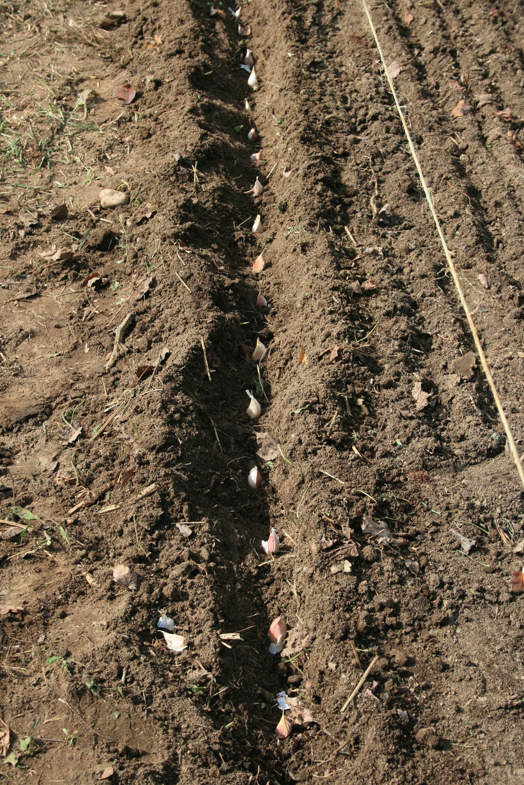
We planted five rows of garlic, in rows nine inches apart. Within each row we planted the garlic six inches apart in a 4-inch deep trench, covering the cloves with about 2 inches of soil. The final layer was a 4-inch layer of clean straw as mulch.

A row of garlic ready for covering with 2 inches of soil

The garlic bed planted and covered in straw

The garlic roots will start to grow and take hold of the ground around, while the green shoots should not break the surface until spring.

Sunday, October 10, 2010

The Robert Frost Trail

The 47-mile Robert Frost Trail runs from the Connecticut River in South Hadley to Ruggles Pond in Wendell State Forest, in west-central Massachusetts. A chunk of the trail passes through my hometown of Amherst, Massachusetts. Kodi and I are spending a view days here at Winterberry Farm, helping my parents with fall clean-up and taking in the scenery.

Kodi and I are just discovering the Robert Frost Trail, especially a section that begins in the Amethyst Brook Conservation Area, a favorite place for dog owners and their dogs.


The trail starts from a parking lot and leads into a meadow that is partly maintained for wildlife and partly used for community gardens. This first opening is where many of the dogs who visit this popular spot first greet each other. From there the trail enters a pine-hemlock woods that borders each side of Amethyst Brook. Earlier this summer the brook was nearly dry, but after recent rains the brook runs strong and clear.

Amethyst Brook

On our first few visits we walked a relatively short loop with other visitors and their dogs up one side of the brook and down the other; two sturdy bridges provide easy access over the brook. Yesterday and today Kodi and I ventured farther along the Robert Frost Trail, reaching the south and west facing ledges of Mt. Orient. Along the way we walked through dark hemlock forest, along a small tributary stream that bubbled out of the wooded mountainside, and then into a dry oak forest, before climbing out onto the ledges, shaded by hickories and white and chestnut oaks.

Chestnut oak, Quercus prinus

Chestnut oak is sometimes called rock oak or ridgetop oak, as it lives on dry, rocky sites. It is more common in the Appalachian region. The trees do not get very big, not nearly as big as their cousins the red and black oaks that also grow along this trail. Chestnut oak leaves are wedge-shaped with rounded lobes. The bark is deeply fissured.

Chestnut oak leaves and bark atop Mt. Orient

A rustic bench hung between two oaks offers a view west toward UMass Amherst and southwest toward the Holyoke Range. We reached this overlook after a relatively easy 45-minute hike from the Amethyst Brook parking lot. Kodi was looking to continue on the trail, but today we turned back.

A view toward UMass, Amherst from Mt. Orient ledges,
on the Robert Frost Trail

A view toward the Holyoke Range from the Mt. Orient ledges

A terrific brochure of the Robert Frost Trail is available online here. The brochure describes individual sections of the trail and includes a topographic map for each leg.

Friday, October 8, 2010

Kodi and Coyotes

We have several regular haunts where we take Kodi for walks, and, if he is lucky, romps with other dogs. As soon as we arrive at one of these places, Kodi pops out of the car all smiles, tail up, nose to the ground or to a blade of grass, and he scans the vicinity for any dogs that he can greet and play with.

Recently I've to come realize that there are a few other places that he does not like. Three, so far, to be exact. At first, I wasn't sure what caused him to be unsettled at these sites -- his tail down, ears back, nose in the air, eyes a little scared. These three places have two things in common: lots of fresh coyote scent and little fresh domestic dog scent. As soon as we start walking at these three places, Kodi's expression says let's go back to the car. And if I don't turn back, he turns back anyway.

My theory is that coyotes are actively marking their territories and their scent is overwhelming to Kodi. He senses something that says stay out, this is coyote country. At the same time, Kodi is not picking up any other more comforting dog smells. Also, we've been to these three places alone, with no other dog, except once.

Last April, just after we adopted Kodi we cared for our friends' dog Teak for two weeks. Teak is a big, friendly German shepherd that Kodi loves to pal around with. Once a day I took Teak and Kodi to Cuba Road (a discontinued class VI road) where they ran and chased each other and generally had a good time. That was the first time Kodi visited Cuba Road. Since then we've tried to go back twice, alone, and both times Kodi darted back toward the car.

Now, all the places we visit likely have coyotes running through them now and then, including our own yard. Perhaps the level of coyote territorial marking and the lack of dog scent determines whether Kodi is comfortable with a place. He seems particularly at ease when other dogs are around or when he smells lots of dogs or when hiking in non-coyote country such as in the mountains.

I will continue to observe Kodi at new places to see if my theory plays out. If we can visit one of his three coyote sites with another dog, I may try that to see if he behaves differently. Maybe we can get Teak back for a visit to Cuba Road. In any event, there is no shortage of Kodi-friendly places to visit so I'm not worried about stifling Kodi's thrill for the outdoors.

Tuesday, October 5, 2010

Davis Path and More

Last weekend we drove north into the heart of the White Mountains, to hike, to see fall colors, and to breathe in the mountain air and try to clear our head colds. Tropical Storm Nicole dropped many inches of rain before we arrived, leaving all rivers and streams running high and fast. As soon as we arrived late Friday afternoon we were sobered by the news that a man had slipped on rocks just 4 miles upstream of where we were staying at a friend's cabin near the Swift River just off the Bear Notch Road.

Saturday dawned clear and breezy. A perfect day for hiking. The night before we studied the trail maps looking for routes that involved the fewest stream crossings given the recent rains and for slightly less popular routes to avoid crowds on this peak fall foliage weekend.

Our two good friends Lisa and Dale had joined us for the weekend. Such a treat to wake up and drive less than 20 minutes to reach a trailhead, rather than the usual 2 hours or so from home. By 9:00 on Saturday we were hiking up the Davis Path, a trail built in 1845 by one man. The trail crosses the Saco River via a sturdy suspension bridge and eventually ends at the top of Mt. Washington, a 15-mile trek one-way.


We hiked only part-way on the Davis Path -- to the top of Mt Crawford (3,119') and to views near the peak of Mt. Resolution (3,415'). The views south and west from these mountains on this mostly sunny fall day were spectacular. The Davis Path from Route 302 to Mt. Crawford is a steady climb into the Presidential Range - Dry River Wilderness. There was nothing dry about the backcountry on this day. Every little drainage and seep had a steady flow and the low sections of trail in the col between Crawford and Resolution were wet and even ponded in places. But nothing dampened our enthusiasm on this day (except the persistent head cold).

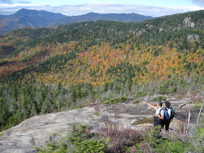
A view from Mt. Crawford
Kodi's spirits too were high. He loved hiking the ledges and wet trails (he wondered why we were stepping so slowly and carefully while for him the deeper the water on the trail the better). Kodi also took in the views.

Kodi waits for us on the ledges enroute to Mt. Crawford

As we stood atop Mt. Crawford admiring 360 degree views of the multicolored hillsides and valleys, my camera battery died. Oh my, I forgot to recharge the battery before this weekend, the most photogenic weekend of the year. Thankfully, Dale documented the rest of our journey and shared his photos.

(All the following photos taken by Dale Wisler)

Srini, me, and Kodi atop Mt.Crawford
Looking northwest toward Crawford Notch, from ledges below Mt. Resolution
A windswept Kodi soaks up the view from ledges below Mt. Resolution

Saturday morning, just after we crossed the Saco River and started up the Davis Path, a huge bull moose crossed the trail in front of us. Kodi was ahead. I yelled to warn Kodi to stay as this was his first encounter with a moose. He gave a bit of chase, but the moose had quickly and silently melted into the woods beyond.

Over the course of two days we crossed several streams that were running higher than normal. We encountered the first crossing on the Davis Path just after spotting the moose. The guide says this stream, a small tributary that drains to the Saco River, is often dry; on Saturday it was not. Such crossings always involve an assessment of which stepping stones to use or perhaps a fallen tree lying across the stream offers an alternative route.

The Davis Path crosses this tributary to the Saco River
Srini crossing a stream on the way to Greeley Ponds
We finished the 9-mile round trip hike to Mt. Crawford and Mt. Resolution in a leisurely 7 hours; pausing often at the many exposed ledges along the way to take in one view after another. On Sunday we hiked the 2.2 miles into the Greeley Ponds south of the Kanc. The morning started cold: the cabin thermometer read 31F. By the time we reached the ponds we had shed some layers, but it was still cool in the shade. The Greeley Ponds trail is a gentle grade that leads into the Mad River Notch through a hardwood forest of sugar and red maples, yellow and paper birch, and beech, all in their fall glory on this day.

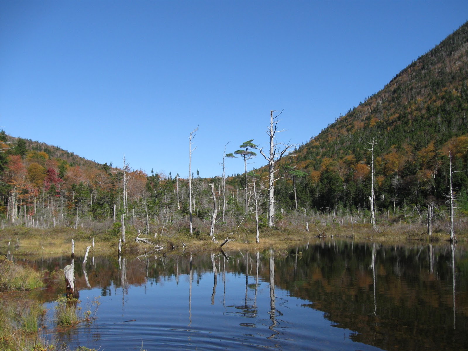
North end of Lower Greeley Pond
The Greeley Ponds are a popular destination as indicated by exposed tree roots on the initial leg of the trail and long strings of bog bridging through muddier sections. We encountered more people today, although we found solitude standing at the edge of the ponds, looking up at Mt. Kancamagus to the east and the more rugged Osceolas to the west and a gorgeous blue sky beyond.

We are already planning our next trip north. We hope Lisa can heal her heel and join us on the next adventure exploring the trails, peaks, and backcountry of this incredibly beautiful region. I'll charge the camera batteries. Kodi is ready anytime.

Friday, October 1, 2010

Out of Sorts

The weather seemed out of sorts yesterday. All day slate-gray clouds moved quickly from southwest to northeast; clouds more suitable to a blustery November day. The air was warm and humid. It felt tropical. We seem to be experiencing the tail end of tropical storm Nicole.

Rain, perhaps heavy rain, was predicted, so I wore then carried my rain coat as Kodi and I walked up Bald Hill Road in the afternoon. Rain this week caused some trees to lose nearly all their leaves. An afternoon breeze shook loose a few more. As they fluttered to the ground some landed on Kodi's back much to his surprise. The shagbark hickories looked a bit shabby in their drab yellows and browns. The multicolored sugar maples -- a mix of red, orange, yellow, and green -- were also dropping leaves. Even two male bluebirds looked muted under the gray sky.

Maybe I was a little out of sorts too. Yesterday I watched as one of our neighbors cut down the few remaining trees in their front yard, including a beautiful mature red oak near the road. This tree had large arching branches that squirrels visited often. In spring, migrant birds -- scarlet tanager, Baltimore oriole, red-eyed vireo -- often arrived there first. There are other oaks in the neighborhood, but this was a beauty and offered shade and homes and food for wildlife.

I am uncertain why our neighbors removed the trees, perhaps to allow more sunlight to reach their house or because of all the acorns and leaves that fall from a mature oak. It is their yard, but now I look across at their bare lawn, their outdoor lights, and cars in the driveway. It suddenly feels more suburban. Cutting down mature trees is always dramatic, especially when a site is suddenly bare of all trees. As days go by I will get used to the new landscape in our neighbor's yard, but I will miss the oak and the squirrel antics and the singing birds.

Ice Out

 Ice Out