For Saturday we chose a loop trail from our Cold River Camp cabin to Eagle Crag, which lies just north of North Baldface Mountain. The 0.7 miles to the first trail junction near the Emerald Pool was easy walking; by then we'd met several other hiking parties heading in the same general direction. At this juncture the hike to Eagle Crag required a water crossing, a crossing that looked a little tenuous so we changed our plans.
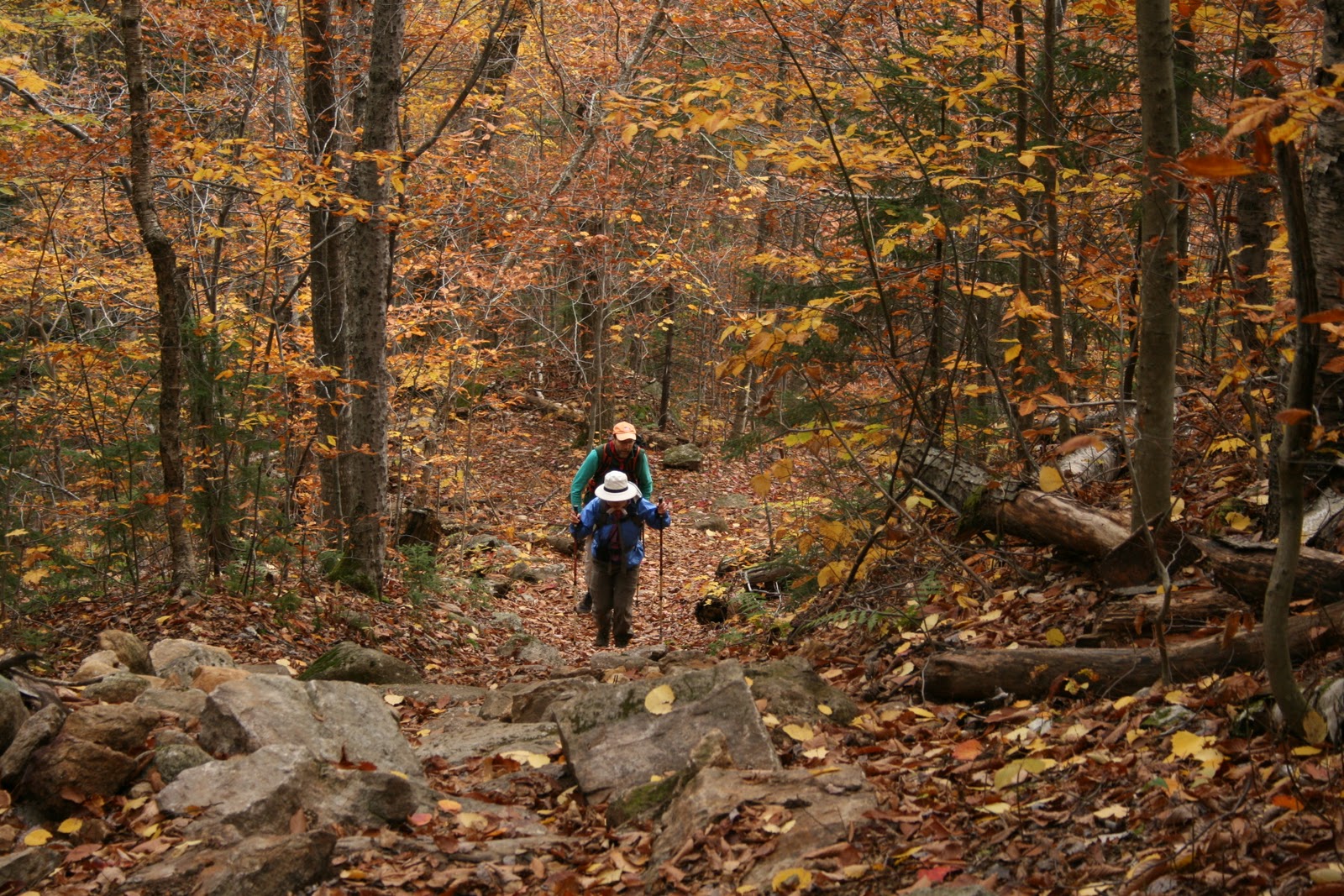
We opted instead to take the Baldface Circle Trail to South Baldface Mountain; this required no major river crossings but did have steep ledges up high. The sky above was gray, while the canopy just above our heads was lit up like a bonfire by beech and other hardwoods in their fall colors.


But alas, a long hike was not in the cards on Saturday. We reached only to the South Baldface shelter, just in time for lunch and just as it started to rain. Many other hikers arrived at the same time, the shelter got a little crowded. We chatted about trail conditions, the steep, upper ledges we were told were quite slick. We made one attempt at the ledges, but changed our plans and headed back the way we came. On the descent we took in the 1/2 mile loop to Chandler Gorge, a worthy side trip from the Baldface Circle Trail.
Despite the twists and turns in our hike on Saturday, the woods were beautiful and the hike as always was rejuvenating. The leaf-covered trail was dotted with fresh raindrops as we turned back toward camp.

Sunday dawned bright, as we observed from Little Deer and Deer Hill and as noted in my post yesterday. Despite a snafu in the morning schedule between us and our friends (Srini, Kodi, and I lingered too long soaking up the sunrise on the Deer Hills!), the four of us (plus Kodi) rallied in late morning for a second Sunday hike. We drove north on Route 113 to the height of land in Evans Notch, a stunning drive in late fall. Our destination -- not to be deterred this time -- was the 3,210-foot West Royce.
By the time we got underway on the East Royce Trail at 10:00 am, the sky had turned a steel gray. No wind stirred, not the slightest breeze. The hike from the parking lot to the top of West Royce was a steady, steep climb from the start. The trail crossed several small streams with cascading falls and climbed through a beech and birch forest.

As we climbed above 2,000 feet in elevation, the trail entered a beautiful spruce forest with lots of little spruces coming up, a soft bed of fallen needles on the trail, and moss and lichens covering large boulders.


Around 2,600 feet a spur trail led to the right up to the peak of East Royce Mountain. We skipped this side trip, continuing on instead to West Royce. The next one mile or so was relatively flat, even dipping down a bit into a mossy, muddy, moosey kind of place. We saw a nice set of fresh moose tracks in the trail. An AMC trail crew did some amazing recent work on the trail, cutting, sawing and placing bog bridges through a wet, muddy stretch that must have taken a beating from Hurricane Irene.

The Royce Trail passed through a hobblebush clearing - the short shrubs were browsed heavily by moose -- before reaching the juncture with the Burnt Mill Brook Trail. This latter trail descends into the Wild River drainage - a wild looking trail if ever there was one. The birch growing in this strange spot were gnarly, the rocks were covered in ferns and moss, and the trail was one long mud hole with small, unruly boulders for stepping stones. It had a Middle Earth sort of feel to it.
Moose-browsed hobblebush and gnarly birch on the Royce Trail
between West Royce and East Royce
between West Royce and East Royce


A crooked sign pointed the way down into the wilds of the Wild River drainage

From here were started up the final 0.7 miles to the top of West Royce. The narrow path snaked its way up through a dark and dense and moist and mossy spruce-fir forest. I brought up the rear, stopping to chat with two friendly boreal chickadees.


The views from the top of West Royce were not spectacular, though the climb to get there was intriguing. We stopped on one of the ledges for lunch, gazing down on Route 113 nestled in the hardwoods below. The gray skies seemed darker, the temperature decidedly cooler.

Clothed in our fleece jackets, hats, and gloves we began our descent, leaving behind the fir and spruce atop the Baldface Royce Range.


Judging from your photos and narrative, I'd say that you still managed to have an enjoyable hike to West Royce, even if the weather conditions were subpar. And after all, it is a rare event indeed to have a truly bad hike! :-)
ReplyDeleteJohn
Hi John - I did enjoy the hike to West Royce. The upper mossy, moody section was quite interesting. A blue sky would have been nice, but gray skies offered a different, mysterious feel.
ReplyDeleteIt's nice to see the pictures of an area I love so much. I don't make it to Evan's Notch as much as I'd like, but there's something wonderful about that part of the White Mountains. Maybe because it seems so much more obscure and remote than the more popular parts with the 4000 Footers and Huts. Thanks for sharing your experiences!
ReplyDeleteThanks Ryan. It is a beautiful area - must be gorgeous now with the recent snow, although I wonder about all the oaks and beeches which took a beating here in southern NH with the wet heavy snow since the trees still had all their leaves.
ReplyDelete