We have the good fortune to spend time, on occasion, at a friends' seasonal house in Jackson, New Hampshire. That is where we stayed Columbus Day weekend. From the porch and front rooms of the Hodge House we looked out across a meadow--maintained for monarchs and mice, swallows and sparrows--and across to the northwest flank of Mount Kearsarge North. Over the course of our four day stay, the leaves of the hardwoods blanketing the hillsides changed to a progressively more brilliant palette of reds, oranges, and yellows.
We could have relaxed at the House House all weekend as the view was so spectacular. But we wanted to get out and hike among the colorful trees, reach more expansive views, and explore the backcountry.
A view from the Hodge House on the day we arrived.
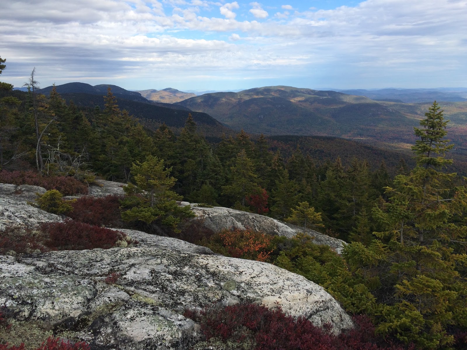
Our hike on Saturday--a 14+ mile loop via the Nancy Pond and Carrigain Notch Trails and Sawyer River Road--was decidedly a backcountry trek. The highlights of the first half of the hike along the Nancy Pond Trail from Route 302 to the Carrigain Notch Trail were: the Nancy Cascades, a moosey and mossy stretch of trail through an old growth spruce-fir forest, Nancy and Norcross Ponds, and views east to Stair Mountain and west into the Pemi Wilderness to the Bonds.
The Nancy Cascades--beautiful and full of falling water--rivaled any waterfalls
that we've seen in the Whites and drought-striken Yosemite.
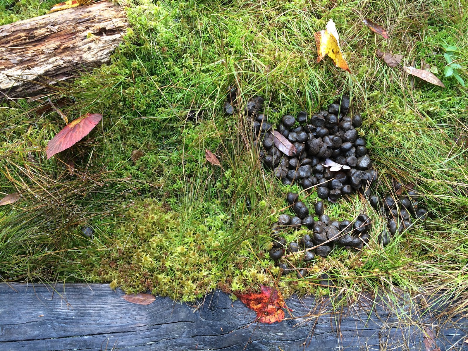
I read one blog write-up of this hike that said the trail from the Cascades to Nancy Pond was "mostly flat terrain and isn't very remarkable." I disagree. The one mile stretch of trail from the falls to the pond climbs then levels out and meanders through a swampy, mossy old spruce-fir forest, with many piles of moose droppings--my favorite kind of place. On Saturday there was also a lingering frost or snow on the vegetation. My favorite images from this area in the heart of the Nancy Pond Research Natural Area:
A view east to Stair Mountain.
By late morning on Saturday snow still lingered on this bracket fungus.
A still life of moose droppings, Sphagnum moss, bog bridge, and fallen fall leaves.
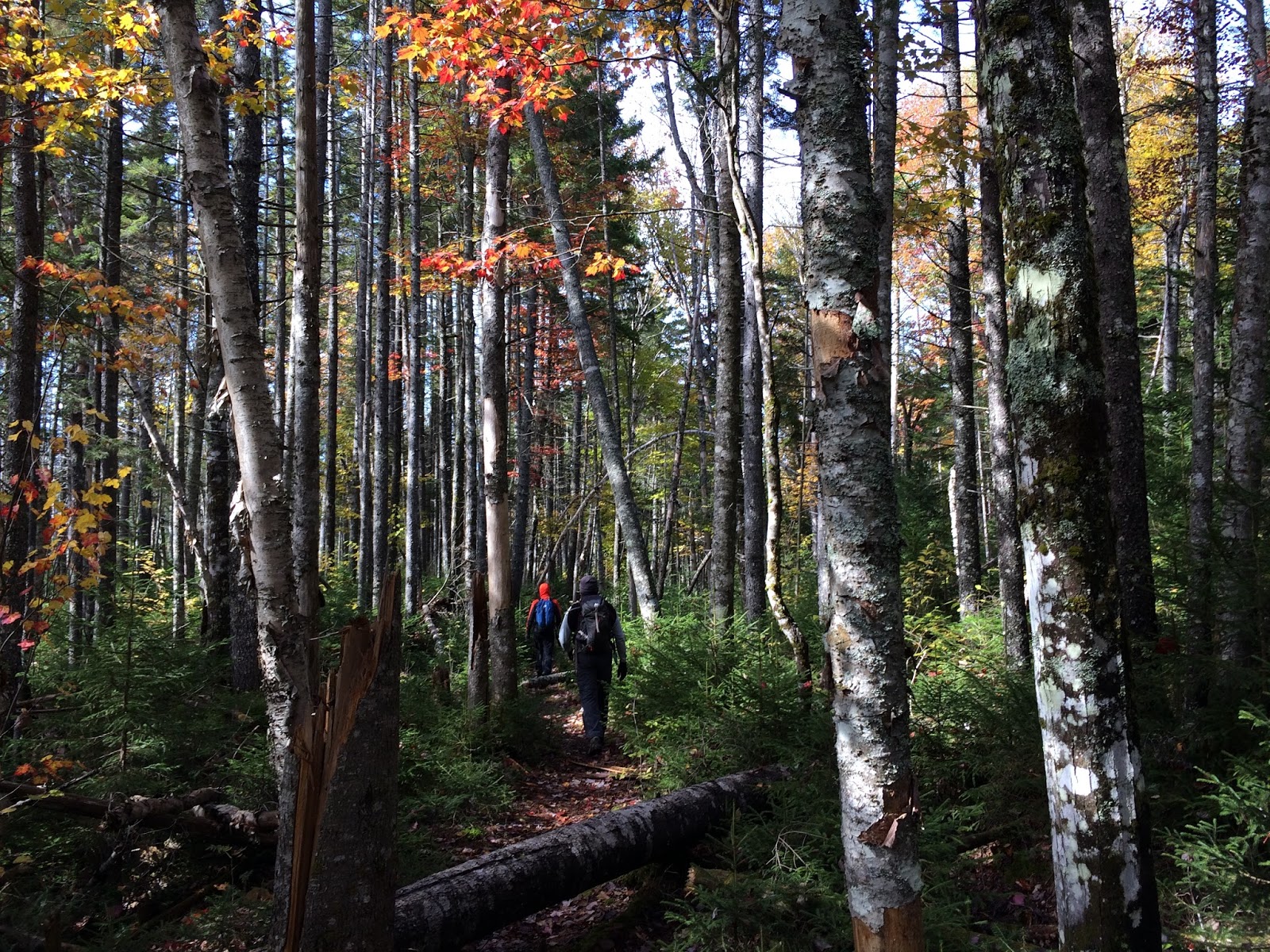
And more images from the Nancy Pond Trail meandering through an old spruce-fir forest.
The trail between Nancy and Norcross Ponds continues through a mossy spruce-fir forest
and on this day the scarlet red Sphagnum moss was stunning.
How can this landscape be described as "unremarkable?"
Steve Smith at Mountain Wondering summarized it well: "For a fairly rugged 8.6 mile round trip, with 2200-ft elevation gain, you can take in towering waterfalls, old growth spruce forest, a pair of high country ponds, and a unique view into a remote corner of the Pemigewasset Wilderness."
The north end of Norcross Pond does provide a fabulous view into the Pemi Wilderness and to the Bonds in the distance.
We paused there only briefly as it was rather cold with an overcast sky, temp hovering around 40, and a stiff wind. It was even colder than we expected. We snapped a few pics then headed down into the Pemi wilderness.
The 7+ miles back on the Carrigain Notch Trail are not rigorous, but it is a long haul back out of the wilderness. But we were in beautiful country, walking through colorful hardwoods and thick spruce and fir regeneration.
This hike was not about the long views. Instead, we wandered through a beautiful forest, with plenty of sign of moose, bear, and grouse, and only a handful of other people throughout the 8 hour hike. The last bit requires walking on Sawyer River Road, but Srini was able to get a lift back to our car on Route 302 from some other hikers (did not get their names, but appreciated the ride!).
Tomorrow I will highlight our Sunday 10-mile hike to South and North Baldface.