Now and then we think seriously about selling our place and moving to town, where we could walk to the library, restaurants, and other amenities. We've just been through another such phase. We toured new apartments in the renovated Newmarket Mills along the Lamprey River in our downtown. The apartments were beautiful and a stone's throw from Main Street. Alas, they do not allow dogs and they are expensive.
Apparently rentals (at least places that you'd want to live in) are expensive most everywhere. The economics don't make sense, especially when we own our own place. So, we ponder the trade-offs. Living in town reduces, but doesn't eliminate, the need to drive. We could participate more fully in community events, given the walkable qualities of our downtown. But the outlay is just too high and there are other compromises.
This afternoon, after spending a beautiful November day walking dogs at the local animal shelter and cleaning up the yard in preparation for winter, we took Kodi for a walk in the neighborhood. Not far from our place is Bald Hill Road, a beautiful rural road bordered by stonewalls and mature trees with open fields beyond. Today we watched a flock of four bluebirds fly from tree to tree along the stonewall. A few crows chased a red-tailed hawk from the same trees, where a pileated woodpecker was also feeding.
This too is why our occasional thoughts about a move end the same way. It is just nice where we are. We hear coyotes and foxes at night, animals large and small live among us, and we can walk out our door to see the stars at night or to pick flowers or vegetables or peaches from our yard.
There is no perfect place to live. The goal I think is to be happy in the moment and make the most of wherever you live. It is a beautiful day in November here on our small piece of the planet.
Sunday, November 6, 2011


Thursday, November 3, 2011
White Oak
One of my favorite trees is the white oak -- Quercus alba. Wildlife like it too. The "sweet" acorns have less tannin than many other oaks and are rich in fat. Animals need to wait longer than kids for their annual "acorn candy" as good crops come only every 4 to 10 years. White oak acorns have a bowl-shaped, shaggy cap. In the photo below, white oak acorns are on the left and red oak acorns are on the right.

White oak trees have shaggy, ashy-gray, sometimes "white" bark. It is the leaves in fall though, that make the tree stand out. The leaves turn a deep red, maroon or purple color. Their leaves seem softer with round lobes, compared to the robust, pointy-lobed leaves of red oak. I noticed that white oaks fared okay in the recent snowstorm, whereas the heavy leaves of the red oak laden with snow wreaked havoc all over.


White oak trees have shaggy, ashy-gray, sometimes "white" bark. It is the leaves in fall though, that make the tree stand out. The leaves turn a deep red, maroon or purple color. Their leaves seem softer with round lobes, compared to the robust, pointy-lobed leaves of red oak. I noticed that white oaks fared okay in the recent snowstorm, whereas the heavy leaves of the red oak laden with snow wreaked havoc all over.
A white oak tree in fall (November 2, 2011)


The fall colors, highlighted by the oaks, are still gorgeous. Squirrels and blue jays are busy caching acorns and other nuts. The cheek pouches of chipmunks are bulging with seeds. Flocks of small birds are passing through, fattening up on insects slowed by the cool temperatures as they head south. A gray squirrel is building a winter nest of red oak leaves at the top of a white pine at the edge of our yard. Lots of activity outside as animals prepare for winter. Take some time to stop and watch, it is fun to see them bustling about.
Tuesday, November 1, 2011
Halloween Storm 2011
Tuesday morning, still no power. Saturday night, as heavy, wet snow fell, we heard a loud pop and then the lights went out. Given the weather forecast we were prepared, although it was still unexpected and more widespread then one could predict.
The oak trees were hardest hit by the heavy snow. They were still carrying all their leaves, this combined with the wet snow was too much even for healthy branches. Many, many roads in southeastern New Hampshire are lined with beautiful oak trees, although it was only a branch here or there that fell. The damage doesn't look that bad, and yet our utility company (PSNH) said it experienced the worst damage to its infrastructure in 140 years.

We have a generator that can run the whole house, a feature that we've used nearly three times a year as these major storms occur more frequently. We fire up the generator for a few hours in the morning and again in the evening for meals and showers and to warm the house and cool the fridge. One neighbor has run his generator continuously since Saturday night. Waking during the night we hear the loud drone of that generator. Another neighbor with three kids seems content with just a wood stove.
Halloween was canceled or postponed -- so lots of tricks and we have to eat all the treats.
The oak trees were hardest hit by the heavy snow. They were still carrying all their leaves, this combined with the wet snow was too much even for healthy branches. Many, many roads in southeastern New Hampshire are lined with beautiful oak trees, although it was only a branch here or there that fell. The damage doesn't look that bad, and yet our utility company (PSNH) said it experienced the worst damage to its infrastructure in 140 years.

We have a generator that can run the whole house, a feature that we've used nearly three times a year as these major storms occur more frequently. We fire up the generator for a few hours in the morning and again in the evening for meals and showers and to warm the house and cool the fridge. One neighbor has run his generator continuously since Saturday night. Waking during the night we hear the loud drone of that generator. Another neighbor with three kids seems content with just a wood stove.
Halloween was canceled or postponed -- so lots of tricks and we have to eat all the treats.
Friday, October 28, 2011
Snow on the Pumpkins
The first snow of the season fell last night. Big, heavy, wet flakes started coming down after dark as the temperature started to slide toward 32F. The temperature slipped a bit below the freezing mark overnight; our first frost, but it wasn't a hard frost.

The pumpkins await carving this weekend in advance of Halloween trick-or-treating, which in our town is Sunday evening - Halloween Eve.

The pumpkins await carving this weekend in advance of Halloween trick-or-treating, which in our town is Sunday evening - Halloween Eve.
Tuesday, October 25, 2011
Evans Notch Continued
Here is part two of our weekend of hiking in Evans Notch.
For Saturday we chose a loop trail from our Cold River Camp cabin to Eagle Crag, which lies just north of North Baldface Mountain. The 0.7 miles to the first trail junction near the Emerald Pool was easy walking; by then we'd met several other hiking parties heading in the same general direction. At this juncture the hike to Eagle Crag required a water crossing, a crossing that looked a little tenuous so we changed our plans.
We opted instead to take the Baldface Circle Trail to South Baldface Mountain; this required no major river crossings but did have steep ledges up high. The sky above was gray, while the canopy just above our heads was lit up like a bonfire by beech and other hardwoods in their fall colors.


But alas, a long hike was not in the cards on Saturday. We reached only to the South Baldface shelter, just in time for lunch and just as it started to rain. Many other hikers arrived at the same time, the shelter got a little crowded. We chatted about trail conditions, the steep, upper ledges we were told were quite slick. We made one attempt at the ledges, but changed our plans and headed back the way we came. On the descent we took in the 1/2 mile loop to Chandler Gorge, a worthy side trip from the Baldface Circle Trail.
Despite the twists and turns in our hike on Saturday, the woods were beautiful and the hike as always was rejuvenating. The leaf-covered trail was dotted with fresh raindrops as we turned back toward camp.

Sunday dawned bright, as we observed from Little Deer and Deer Hill and as noted in my post yesterday. Despite a snafu in the morning schedule between us and our friends (Srini, Kodi, and I lingered too long soaking up the sunrise on the Deer Hills!), the four of us (plus Kodi) rallied in late morning for a second Sunday hike. We drove north on Route 113 to the height of land in Evans Notch, a stunning drive in late fall. Our destination -- not to be deterred this time -- was the 3,210-foot West Royce.
By the time we got underway on the East Royce Trail at 10:00 am, the sky had turned a steel gray. No wind stirred, not the slightest breeze. The hike from the parking lot to the top of West Royce was a steady, steep climb from the start. The trail crossed several small streams with cascading falls and climbed through a beech and birch forest.


As we climbed above 2,000 feet in elevation, the trail entered a beautiful spruce forest with lots of little spruces coming up, a soft bed of fallen needles on the trail, and moss and lichens covering large boulders.


Around 2,600 feet a spur trail led to the right up to the peak of East Royce Mountain. We skipped this side trip, continuing on instead to West Royce. The next one mile or so was relatively flat, even dipping down a bit into a mossy, muddy, moosey kind of place. We saw a nice set of fresh moose tracks in the trail. An AMC trail crew did some amazing recent work on the trail, cutting, sawing and placing bog bridges through a wet, muddy stretch that must have taken a beating from Hurricane Irene.

The Royce Trail passed through a hobblebush clearing - the short shrubs were browsed heavily by moose -- before reaching the juncture with the Burnt Mill Brook Trail. This latter trail descends into the Wild River drainage - a wild looking trail if ever there was one. The birch growing in this strange spot were gnarly, the rocks were covered in ferns and moss, and the trail was one long mud hole with small, unruly boulders for stepping stones. It had a Middle Earth sort of feel to it.


From here were started up the final 0.7 miles to the top of West Royce. The narrow path snaked its way up through a dark and dense and moist and mossy spruce-fir forest. I brought up the rear, stopping to chat with two friendly boreal chickadees.


The views from the top of West Royce were not spectacular, though the climb to get there was intriguing. We stopped on one of the ledges for lunch, gazing down on Route 113 nestled in the hardwoods below. The gray skies seemed darker, the temperature decidedly cooler.

Clothed in our fleece jackets, hats, and gloves we began our descent, leaving behind the fir and spruce atop the Baldface Royce Range.


For Saturday we chose a loop trail from our Cold River Camp cabin to Eagle Crag, which lies just north of North Baldface Mountain. The 0.7 miles to the first trail junction near the Emerald Pool was easy walking; by then we'd met several other hiking parties heading in the same general direction. At this juncture the hike to Eagle Crag required a water crossing, a crossing that looked a little tenuous so we changed our plans.
We opted instead to take the Baldface Circle Trail to South Baldface Mountain; this required no major river crossings but did have steep ledges up high. The sky above was gray, while the canopy just above our heads was lit up like a bonfire by beech and other hardwoods in their fall colors.


But alas, a long hike was not in the cards on Saturday. We reached only to the South Baldface shelter, just in time for lunch and just as it started to rain. Many other hikers arrived at the same time, the shelter got a little crowded. We chatted about trail conditions, the steep, upper ledges we were told were quite slick. We made one attempt at the ledges, but changed our plans and headed back the way we came. On the descent we took in the 1/2 mile loop to Chandler Gorge, a worthy side trip from the Baldface Circle Trail.
Despite the twists and turns in our hike on Saturday, the woods were beautiful and the hike as always was rejuvenating. The leaf-covered trail was dotted with fresh raindrops as we turned back toward camp.

Sunday dawned bright, as we observed from Little Deer and Deer Hill and as noted in my post yesterday. Despite a snafu in the morning schedule between us and our friends (Srini, Kodi, and I lingered too long soaking up the sunrise on the Deer Hills!), the four of us (plus Kodi) rallied in late morning for a second Sunday hike. We drove north on Route 113 to the height of land in Evans Notch, a stunning drive in late fall. Our destination -- not to be deterred this time -- was the 3,210-foot West Royce.
By the time we got underway on the East Royce Trail at 10:00 am, the sky had turned a steel gray. No wind stirred, not the slightest breeze. The hike from the parking lot to the top of West Royce was a steady, steep climb from the start. The trail crossed several small streams with cascading falls and climbed through a beech and birch forest.
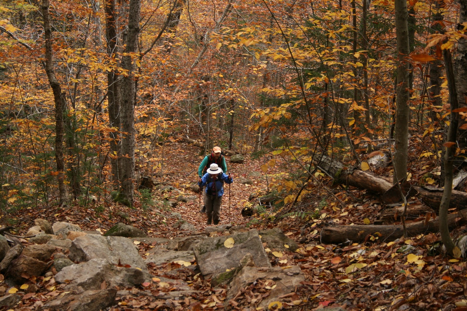

As we climbed above 2,000 feet in elevation, the trail entered a beautiful spruce forest with lots of little spruces coming up, a soft bed of fallen needles on the trail, and moss and lichens covering large boulders.


Around 2,600 feet a spur trail led to the right up to the peak of East Royce Mountain. We skipped this side trip, continuing on instead to West Royce. The next one mile or so was relatively flat, even dipping down a bit into a mossy, muddy, moosey kind of place. We saw a nice set of fresh moose tracks in the trail. An AMC trail crew did some amazing recent work on the trail, cutting, sawing and placing bog bridges through a wet, muddy stretch that must have taken a beating from Hurricane Irene.

The Royce Trail passed through a hobblebush clearing - the short shrubs were browsed heavily by moose -- before reaching the juncture with the Burnt Mill Brook Trail. This latter trail descends into the Wild River drainage - a wild looking trail if ever there was one. The birch growing in this strange spot were gnarly, the rocks were covered in ferns and moss, and the trail was one long mud hole with small, unruly boulders for stepping stones. It had a Middle Earth sort of feel to it.
Moose-browsed hobblebush and gnarly birch on the Royce Trail
between West Royce and East Royce
between West Royce and East Royce


A crooked sign pointed the way down into the wilds of the Wild River drainage

From here were started up the final 0.7 miles to the top of West Royce. The narrow path snaked its way up through a dark and dense and moist and mossy spruce-fir forest. I brought up the rear, stopping to chat with two friendly boreal chickadees.


The views from the top of West Royce were not spectacular, though the climb to get there was intriguing. We stopped on one of the ledges for lunch, gazing down on Route 113 nestled in the hardwoods below. The gray skies seemed darker, the temperature decidedly cooler.

Clothed in our fleece jackets, hats, and gloves we began our descent, leaving behind the fir and spruce atop the Baldface Royce Range.


Monday, October 24, 2011
Evans Notch
Route 113 winds its way up through Evans Notch on the eastern side of the White Mountain National Forest. The windy, scenic road begins in the broad floodplain of the Saco River in Fryeburg, Maine. By the time you reach the Notch you've crossed back and forth between Maine and New Hampshire a few times. We spent the weekend hiking this region, staying at the Appalachian Mountain Club's Cold River Camp. The Camp is bustling with visitors and staff in summer, but in the off-season only one cabin is available for overnight stays. Our friends Dale and Lisa snagged a 2-night booking for the four us, a terrific "base camp" for two days of nearby hiking.
The weekend weather was not terribly cooperative, yet we squeezed in some superb hiking on woodland trails cloaked in golden yellow leaves and through spruce forests draped in moss. Our destinations took us to some fabulous views. My motto though was to not miss the forest for the views. The woods and rocks and waterfalls were just as inspiring as the views.
One of the sweetest hikes was a Sunday morning sunrise hike to the diminutive Little Deer Hill and Deer Hill in Maine. We reached these 1,000-footers from our cabin at Cold River. A camp trail leads down to the river then crosses to the other side via a dam built in the 1960s. This same spot can be reached from the Baldface Circle parking lot taking the Deer Hill Connector. We actually hiked to Little Deer twice - Friday night just at sunset and then again Sunday morning. Kodi made the crossing fine on Friday, but needed a lift across the middle part on Sunday.


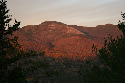
The hike to the Deer Hills was a 3.5 to 4 mile hike up and down and around wooded slopes with some ledges near the top. We reached the top of Little Deer Hill after a 30 minute hike from the cabin - just at sunrise. the Baldface Royce Range to our west was bathed in morning light. The valley below was cloaked in morning fog. South Baldface stands out with its broad, bald face.




The weekend weather was not terribly cooperative, yet we squeezed in some superb hiking on woodland trails cloaked in golden yellow leaves and through spruce forests draped in moss. Our destinations took us to some fabulous views. My motto though was to not miss the forest for the views. The woods and rocks and waterfalls were just as inspiring as the views.
One of the sweetest hikes was a Sunday morning sunrise hike to the diminutive Little Deer Hill and Deer Hill in Maine. We reached these 1,000-footers from our cabin at Cold River. A camp trail leads down to the river then crosses to the other side via a dam built in the 1960s. This same spot can be reached from the Baldface Circle parking lot taking the Deer Hill Connector. We actually hiked to Little Deer twice - Friday night just at sunset and then again Sunday morning. Kodi made the crossing fine on Friday, but needed a lift across the middle part on Sunday.


Just after you cross the Cold River you reach the state line.

The hike to the Deer Hills was a 3.5 to 4 mile hike up and down and around wooded slopes with some ledges near the top. We reached the top of Little Deer Hill after a 30 minute hike from the cabin - just at sunrise. the Baldface Royce Range to our west was bathed in morning light. The valley below was cloaked in morning fog. South Baldface stands out with its broad, bald face.


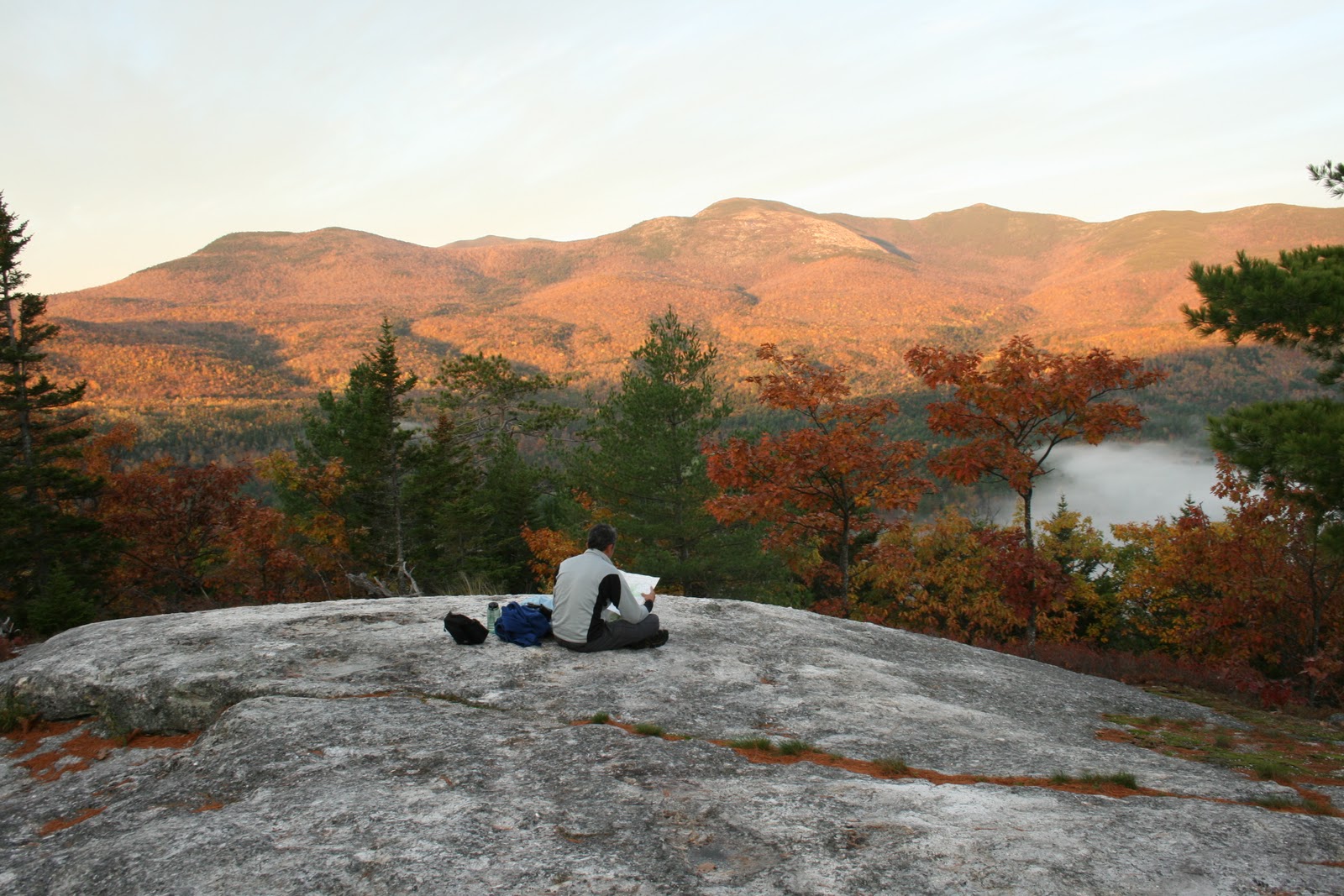

Kodi sat on Little Deer Hill taking in the sunrise.

As the fog began to lift in the valley below, we headed to Deer Hill.

The 0.7 mile trail over to Deer Hill is first down then back up. The top of Deer Hill (1,327') is wooded with little view. Continuing on the Deer Hills Trail another 100 feet leads to a lower ledge and a fabulous view. We sat looking east absorbing the warmth of the morning sun as it rose over Palmer and Adams Mountains. The entire length of Kezar Lake was hidden by fog.


The Chatham Trails Association maintains 40 miles of trails in this region. From our experience on this little hike they do excellent work, keeping trails open and maintaining nice trail signs. Thank you CTA.

The oak forest on the east and south slopes of Deer Hill is beautiful, the red and black oaks tall and stately and gorgeous in their fall colors. The understory of golden yellow beech leaves lit up the forest, something we experienced all weekend.


Our loop hike brought us back to Little Deer Hill, before we descended back to camp. By this time of the morning the fog had cleared and the Baldface Royce Range looked bright and welcoming. The bluish sky promised a good day of hiking, but alas the clouds returned. More tomorrow on our weekend of hiking, including our Saturday attempt at Eagle Crag and a second hike on Sunday to West Royce.
Until then, here is the Baldface Royce Range again on Sunday morning before we descended to camp. Sometimes the smallest hills give you the best views.


The Chatham Trails Association maintains 40 miles of trails in this region. From our experience on this little hike they do excellent work, keeping trails open and maintaining nice trail signs. Thank you CTA.

The oak forest on the east and south slopes of Deer Hill is beautiful, the red and black oaks tall and stately and gorgeous in their fall colors. The understory of golden yellow beech leaves lit up the forest, something we experienced all weekend.


Our loop hike brought us back to Little Deer Hill, before we descended back to camp. By this time of the morning the fog had cleared and the Baldface Royce Range looked bright and welcoming. The bluish sky promised a good day of hiking, but alas the clouds returned. More tomorrow on our weekend of hiking, including our Saturday attempt at Eagle Crag and a second hike on Sunday to West Royce.
Until then, here is the Baldface Royce Range again on Sunday morning before we descended to camp. Sometimes the smallest hills give you the best views.
South Baldface Mtn and North Baldface Mtn from Little Deer Hill

Mt. Meader from Little Deer Hill

The Basin from Little Deer Hill.

Subscribe to:
Posts (Atom)
-
 Whenever it rains hard during the summer, pine cones seem to rain down, the cones knocked from branches in the upper canopy of tall white pi...
-
 It was a mourning dove, the pile of feathers beneath the tall white pine. The feathers that I showed yesterday in my blog. You can tell by t...
-
 The oldest known hardwood tree in North America--at 700 years old--is a black gum tree tucked away in a hummocky swamp in southern New Hamps...