Saturday dawned clear and breezy. A perfect day for hiking. The night before we studied the trail maps looking for routes that involved the fewest stream crossings given the recent rains and for slightly less popular routes to avoid crowds on this peak fall foliage weekend.
Our two good friends Lisa and Dale had joined us for the weekend. Such a treat to wake up and drive less than 20 minutes to reach a trailhead, rather than the usual 2 hours or so from home. By 9:00 on Saturday we were hiking up the Davis Path, a trail built in 1845 by one man. The trail crosses the Saco River via a sturdy suspension bridge and eventually ends at the top of Mt. Washington, a 15-mile trek one-way.

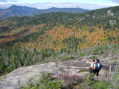
We hiked only part-way on the Davis Path -- to the top of Mt Crawford (3,119') and to views near the peak of Mt. Resolution (3,415'). The views south and west from these mountains on this mostly sunny fall day were spectacular. The Davis Path from Route 302 to Mt. Crawford is a steady climb into the Presidential Range - Dry River Wilderness. There was nothing dry about the backcountry on this day. Every little drainage and seep had a steady flow and the low sections of trail in the col between Crawford and Resolution were wet and even ponded in places. But nothing dampened our enthusiasm on this day (except the persistent head cold).

A view from Mt. Crawford
Kodi's spirits too were high. He loved hiking the ledges and wet trails (he wondered why we were stepping so slowly and carefully while for him the deeper the water on the trail the better). Kodi also took in the views.
Kodi waits for us on the ledges enroute to Mt. Crawford
As we stood atop Mt. Crawford admiring 360 degree views of the multicolored hillsides and valleys, my camera battery died. Oh my, I forgot to recharge the battery before this weekend, the most photogenic weekend of the year. Thankfully, Dale documented the rest of our journey and shared his photos.
(All the following photos taken by Dale Wisler)
 |
| Srini, me, and Kodi atop Mt.Crawford |
 |
| Looking northwest toward Crawford Notch, from ledges below Mt. Resolution |
 | |
| A windswept Kodi soaks up the view from ledges below Mt. Resolution |
Saturday morning, just after we crossed the Saco River and started up the Davis Path, a huge bull moose crossed the trail in front of us. Kodi was ahead. I yelled to warn Kodi to stay as this was his first encounter with a moose. He gave a bit of chase, but the moose had quickly and silently melted into the woods beyond.
Over the course of two days we crossed several streams that were running higher than normal. We encountered the first crossing on the Davis Path just after spotting the moose. The guide says this stream, a small tributary that drains to the Saco River, is often dry; on Saturday it was not. Such crossings always involve an assessment of which stepping stones to use or perhaps a fallen tree lying across the stream offers an alternative route.
 |
| The Davis Path crosses this tributary to the Saco River |
 |
| Srini crossing a stream on the way to Greeley Ponds |
 |
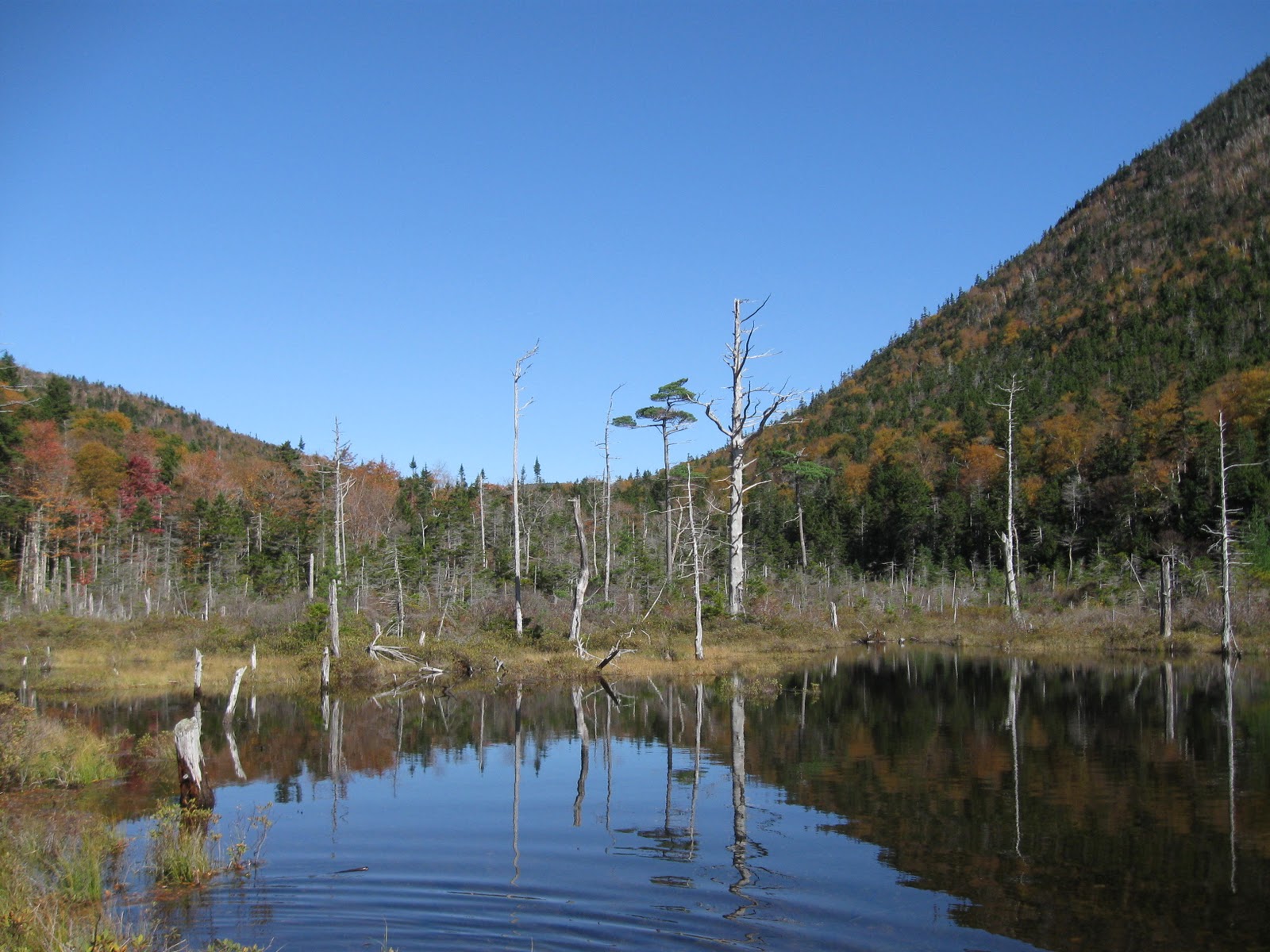
| North end of Lower Greeley Pond |
We are already planning our next trip north. We hope Lisa can heal her heel and join us on the next adventure exploring the trails, peaks, and backcountry of this incredibly beautiful region. I'll charge the camera batteries. Kodi is ready anytime.


It's such a special time of the year up here. Your photos capture that well.
ReplyDeleteI'm also happy to see Kodi making his way through the mountains, soaking in the views.
Your photos are wonderful! I hope there are few leaves left by the time we head north in a few weeks. It will be time to shut off the water--back to the winter hardship of hauling water! Glad you had such a great weekend!
ReplyDeleteThanks Malin!!
ReplyDelete